Written by Alisa Clickenger | Photos by Edward Wilkinson and Alisa Clickenger. Posted in Rides
There’s an undeniable mystique to the American West. Cowboys, Indians, outlaws and the Gold Rush—they all call as loudly as the wide open landscape itself. Inspired by our friend and Backcountry Byways author, Tony Huegel, and the custom routing he was working on for one of his adventure riding motorcycle clients, we decided to build a trip around this magnificently desolate place he refers to as “The Great Empty.”

It’s the big area of “nothingness” south of Lander, Wyoming, and north of Interstate 80, where there are very few roads and even fewer people. Originally from the east coast and now living in Idaho Falls, we have become increasingly enchanted with the western way of life and all the places to escape into the wilderness. With a newly purchased KTM 950 Adventure in the garage alongside my partner Edward’s KTM Super Enduro, the pull of the wide open west was too much for either of us to deny.
After months of Edward’s obsessive planning, we headed out of Idaho Falls on I-15 for about 40 miles. Exiting the highway at Mud Lake, we went north, taking some nice double track over Bannack Pass and crossing into Montana. We rode in a northerly direction for several hours, through miles of open range, leaving civilization farther and farther behind.
Medicine Lodge Creek Road brought us to Bannack State Park, the site of Montana’s first major gold discovery in 1862. The town was named after the local tribe of Bannock Indians, and swelled to around 10,000 people in its heyday. Bannack was also the capital of the Wyoming Territory for a brief period of time.
Once gold was discovered in nearby Virginia City, the population slowly dwindled until the last of the residents moved out in the 1970s. Now a National Historic Landmark with over 60 buildings, Bannack State Park is the best preserved of all of Montana’s ghost towns.
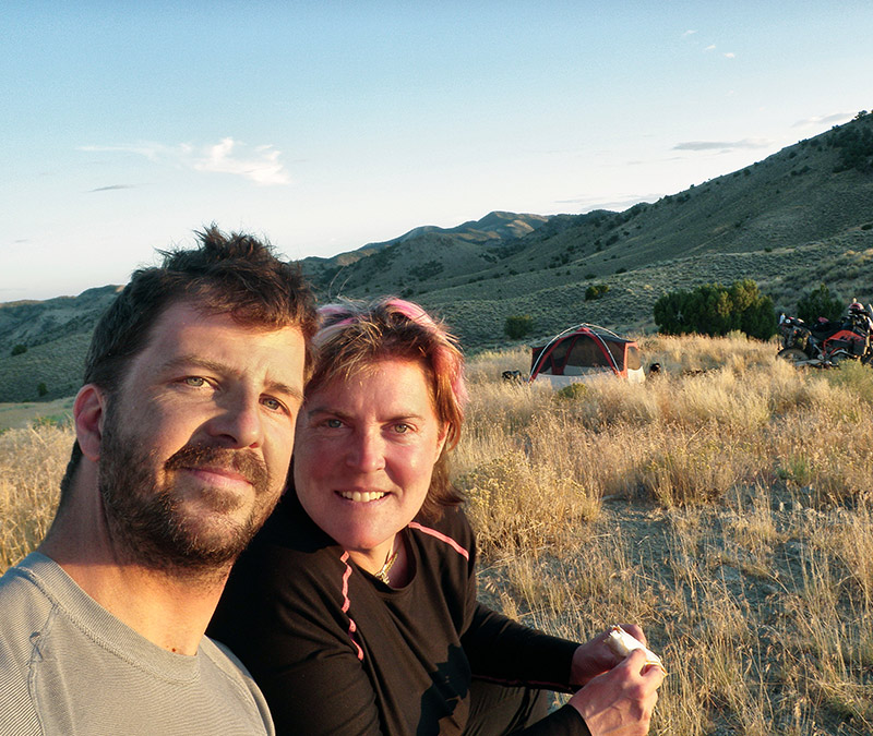
After nearly an entire day of solitude on the gravel roads, the number of tourists at the State Park was a jolt. When we were told that the fee was $22 to camp among barking dogs and belching RVs, we consulted the GPS and found a remote place on public land where we dry camped, sharing the last of the afternoon shade with a group of friendly cows.
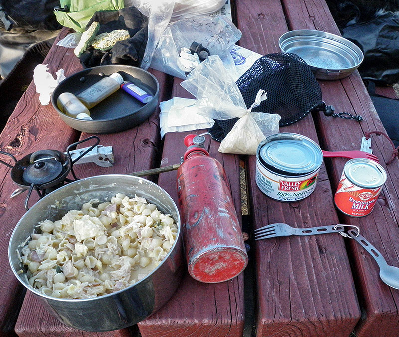
Note in Edward’s journal: “No cars for hours. Chicken fajitas and three beers for dinner. Good start to the trip.”
We were at elevation and it was a cold night. Edward’s Super Enduro had trouble starting, so we rolled our bikes into the sunshine and waited. A while later everything had warmed up enough to kick over the engines and we rode out. With a huge hot breakfast in Dillon, Montana, we then headed for the Gravelly Range.
In the Gravellies, being virtually roadless means that what few roadways there are take your breath away. There’s a high elevation drive along the crest, with undulating mountain views on either side for miles. Part of the Beaverhead-Deerlodge National Forest, there are no services once you leave the highway, which suited us just fine with our inclination towards the wild and the remote.
The gravel road was easy and unchallenging, so it was effortless to focus on the alpine vistas, open foothills and coniferous forests interspersed with mountain meadows. We found ourselves riding separately yet together, each enchanted with the scenery. Later, I read that there are well over 250 species of wildflowers, grasses, shrubs, and trees occurring along the route. Even though the blooming starts in late June and runs through July, it was spectacular even in early September.
We spent most of the day under the enchantment of the Gravellies and considered camping there, but given our KTMs’ objections to the cold that morning, we knew that at 9000-plus feet of elevation we’d waste the next day’s precious riding time waiting for the mountain chill to recede.
Instead, we rode down to a campsite Edward knew in Red Rock Lakes National Wildlife Refuge. Spectacular in its own right, my only hesitation was the abandoned horse trailer with a multiplicity of printed admonitions to use it for food storage in case of bears.
Note in Edward’s journal: “Gravelly Range Loop was AWESOME! We must come back.”
We awoke to the serenade of trumpeter swans at dawn and ate our blissfully-unmolested-by-bears breakfast in camp overlooking the lake. Shortly after riding out we left the gravel roads and covered some ground along a section of the John D. Rockefeller Parkway, which connects Grand Teton National Park to Yellowstone National Park. Stopping for lunch at a picnic area, Edward braved the frigid waters of the Snake River for a bath. I refused.
Back on gravel, we rode over Union Pass at 9,300 feet. I was getting tired and making more riding mistakes than I cared for; however, it seemed to take forever to find a suitable camping spot that wasn’t private farmland. I stopped a passing pickup truck to ask a local where to camp, and he directed us to a spot on his land along the river, with a firm admonition to be on the look out for bears. Did I mention I have a thing about camping in bear country?
While discussing bear stalking and feeding theories, and what path a bear might take while crossing the river into our camp, Edward eventually walked away and started making dinner. He left me to put up the tent. When I was finished to the best of my bear-phobic satisfaction, I brought my chair over to the dirt area where he’d unpacked the stove and was boiling water for a dehydrated camping meal.
“Is that smoke?” I asked looking over his shoulder. He turned towards where I was looking and, as if time stood still, we both sat stupefied, seeing the black smoke of wildfire on the other side of the closest range of hills. We looked at each other and nodded simultaneously; with silent agreement we abandoned dinner, packed up camp and moved on.
Several hours of riding in the dark later, we passed through Pinedale, Wyoming. We navigated out of town to a remote spot Edward remembered from a previous trip. We set up the tent like robots using our head lamps to guide our actions, and crashed into our sleeping bags without eating.
Riding Lander Pass we were on gravel roads once again when we encountered a dirt and rain storm. The violent winds of a dark storm that the western states seem to brew up so easily was tossing the freshly graveled surface into the sky. Somehow we made it to the Lander Cutoff Road.
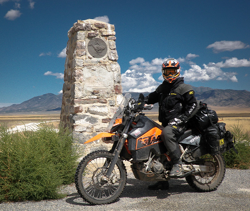
As the sky cleared, we found ourselves at a famous landmark — the intersection of the Oregon Trail, California Trail, Mormon Trail and the Pony Express, before departing on the Oregon Trail through a whole lot of empty landscape.
Despite being used by 400,000 settlers migrating west across the United States, the Oregon Trail was difficult to ride. Two deep trenches, the width of wagon wheels, remain as a reminder of how difficult it was for settlers to travel through the harsh and inhospitable terrain. Riding our big bikes in the cavernous ruts was a workout.
The next day we came to South Pass City, the site of Wyoming’s biggest gold boom and bust. A lonely, windswept graveyard stood above town. The South Pass City State Historic Site preserves more than 30 historic structures, and the Continental Divide National Scenic Trail also passes through town. With a population of about seven people, “town,” is a stretch of the term—we didn’t expect to find any services there.
The Carissa Mine stands just beyond town, an immense structure which permanently ceased operations in 1954. The state of Wyoming purchased the Carissa in 2003, and has financed a massive renovation, including re-purchasing several essential pieces of equipment previously sold off. The Carissa can now be toured Memorial Day through Labor Day, but we were too late in the season.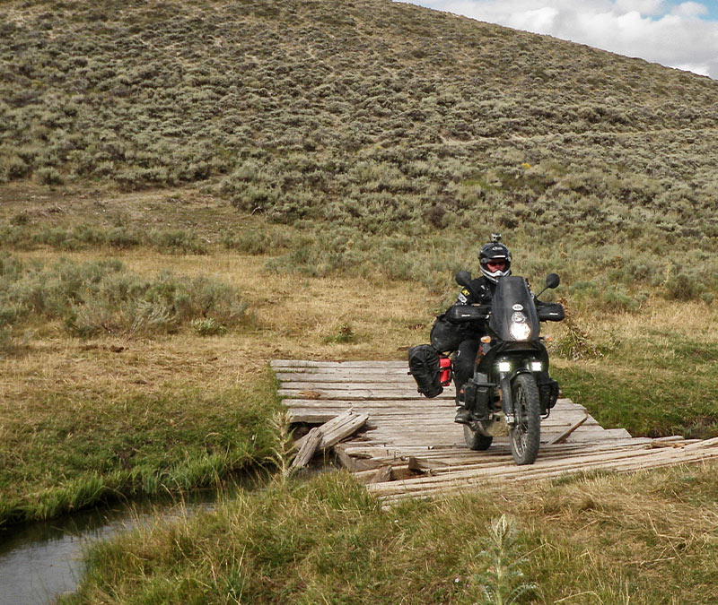 In Atlantic City, Wyoming, we were drawn into the Atlantic City Mercantile, where history is alive in the décor as well as the preserved building itself. Atlantic City, with its 37 residents, is a metropolis compared to South Pass City. We left the friendly locals and decided to push on because we were now on the edge of the Great Empty—the crown jewel of this trip.
Note in Edward’s journal: “Nice morning. Many hours of the Great Empty. Great Riding.”
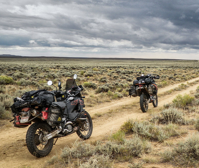
There were no houses. No ranches. Only endless horizon and little-used roadbed. According to the GPS, the nearest highway was over 60 miles away. We passed a sign for the Sweetwater Uranium mine, of all things, and knew we were beyond nowhere.
There wasn’t another soul around; the only vestige of humanity an abandoned and derelict settlement where a hardy soul had once tried to make a go of it in this harsh and unforgiving environment. Even when expecting a vast, empty plain, we were astonished at the desolation of this part of southwestern Wyoming.
In many places there was no visible life—not even the normally ubiquitous sagebrush. Just mile after mile of wide open road, fascinatingly empty landscape and nothing but the noise of the wind for company. We pressed on; knowing that if needed, it was doubtful there would be any salvation.
Note in Edward’s journal: “‘Holy Crap… I hope this goes through,’ was all I could think today. I’m glad I did my research.”
Eventually the formidable landscape gave way to low scrub and cow country and we came to a small stream where things were slightly greener and a little more forgiving. We found the bovine companionship gathered around the small patch of green reassuring company after all that great empty space, enough so that we decided to stop for the night.
The next morning we packed up and left our little oasis, setting out through the Great Empty yet again. The sun beat down, the road stretched on long and straight, and the dust plume behind us went on and on, lingering in the air long after the roar of our KTMs melted into the horizon.
Helpful Resources:
• Backcountry Byways Custom Trip Routing
Tony Huegel
BackcountryByways.com
• Bannack State Park
721 Bannack Rd
Dillon, MT 59725
Latitude/Longitude: (45.16212 / -112.99868)
StateParks.mt.gov/bannack
Open year round
Fall/Spring: 8 am–5 pm
Summer: 8 am–9 pm
• South Pass City and Carissa Mine
• Benchmark Maps
BenchmarkMaps.com

 By
By